Journey to the Antarctic: Bird Island (1982)

Bird Island Research Station, Bird Island, South Georgia Dec 1982

Bird Island lies off the north-west tip of South Georgia, (Lat. 54°0’0″S, Long. 38°2’59″W) (below).

Map of South Georgia (By Apcbg – Own work, Wiki CC BY-SA 3.0)
South Georgia near Bird Island (1982)

There is a small research station – Bird Island Research Station – which is run by the British Antarctic Survey, and is ideally suited – being right in the middle of a huge fur seal colony! – to study the amazing wildlife present on this small island, which is only about 3 miles long.

Antarctic fur seal and Wandering Albatross on Bird Island (1982)

According to Wikipedia (the figures may not be completely up-to-date) there are, on this small island:

RFD off Bird Island, South Georgia (1982)

We arrived on Bird Island on 1st Dec 1982, having previously sailed all the way up to Montevideo and back, on the RRS John Biscoe, to collect more personnel to take south. (N.B. it was not possible for civilians to fly via the Falkland Islands at the time). See previous blog here.

South Georgia near Bird Island (1982)

Although we had a limited time at this location, and the priority was to resupply the base (see below), I was very keen to get ashore and see some of the wildlife.

Going ashore in the scow, Bird Island

We all mucked in and helped with the unloading. Parcels and supplies were carried from the scow (above), up the beach and along a temporary plank walk (below) to the base.

Bird Island, South Georgia 2 Dec 1982

Because we were walking through a breeding colony of Antarctic fur seals, the large, territorial males had to be temporarily walled off behind a row of oil drums, to dissuade them from sinking their teeth into our thighs!

Antarctic fur seal (Arctocephalus gazella) colony, Bird Island

The large males are very splendid fellows in the middle of their large harems (above).

Antarctic Fur Seal (Liam Quinn Flickr (CC BY-SA 2.0)

Once we had finished unloading, some of us climbed up the nearby hill to photograph some of the Black-browed albatross (Thalassarche melanophris) which were nesting above the base (below).

Black-browed albatross (Thalassarche melanophris) Bird island, South Georgia

We probably came too close to these birds than we should have done (below), but none of us had long lenses in those days!

Black-browed albatross (Thalassarche melanophris) Bird island

I will include a few more recent pictures of these graceful birds (below) which some photographers have donated to the Creative Commons, meaning that they are licensed to copy and in any medium or format (CC BY-SA 2.0). Otherwise photographs are usually ‘All Rights Reserved’ and cannot be copied and reused without permission (and often with payment) from the photographer. I suspect that most people who cut and paste images off the internet are unaware of these rules; but that’s getting off the point. It is just great that some photographers allow their images to be used freely, like some shown in this blog.

Black-browed Albatross (Thalassarche melanophrys) On West Point Island in the Falkland Islands. Liam Quinn from Canada (Wiki CC BY-SA)
Black-browed albatross, falkland islands (Image by Claudia Kirchberger from Pixabay)

Unfortunately, the Black-browed albatross population on Bird Island has been in a long-term decline in breeding numbers since the mid-1970s (see graph below). It shows how numbers of birds have declined markedly since I visited in 1982.

Population trend of the Black-browed Albatross at Bird Island

Tragically they are often “caught on fishing hooks (bycatch or incidental catch), by longline trawlers. Read more about this terrible crisis which is decimating albatross numbers, here and here.

Another majestic bird breeding on Bird Island is the Wandering Albatross (Diomedea exulans) (below).

Wandering albatross (Diomedea exulans) Photo by Bernard Spragg. NZ (Flickr CC) CC0 1.0 Universal (CC0 1.0)

There was a Wandering albatross chick wandering about the base, getting in the way of our unloading, which had to be persuaded to go elsewhere for the day!

Wandering albatross (Diomedea exulans) chick, Bird Island, South Georgia, 1982

The wandering albatross has the longest wingspan of any living bird, typically ranging from 2.51 to 3.5 m (8 ft 3 in to 11 ft 6 in).

Wandering albatross (Diomedea_exulans) in flight (By By JJ Harrison Own work, Wiki CC BY-SA 3.0. See his website: https://www.jjharrison.com.au/)

Unfortunately, it’s the same tragic story again, with Wanderers declining in numbers between the mid 1990s and the mid 2000s (>4% per annum), although the rapid downturn appears to have stabilized, with numbers remaining relatively stable over the last 7-8 years, “albeit at a substantially reduced level compared with the number of breeding pairs present in the 1960s and with no signs yet of a recovery in numbers.” (See graph and reference below).

Population trend of the Wandering Albatross at Bird Island
Black-browed Albatross (Thalassarche melanophrys) By JJ Harrison Own work, Wiki CC BY-SA 3.0. See his website: https://www.jjharrison.com.au/)

We can only hope that with more people visiting the Antarctic, and becoming aware of the fact that these magnificent creatures are getting caught up on fishing lines, or ingesting our plastic rubbish floating in the oceans, that more is done to say the thousands that are getting killed each year. Especially by illegal fishing: see here and here.

Black-browed Albatross (Thalassarche melanophrys) in flight (By JJ Harrison Own work, Wiki CC BY-SA 3.0, see his website: https://www.jjharrison.com.au/)

Useful links

https://friendofthesea.org/marine-conservation-projects-and-awareness/save-the-albatros/

https://www.birdlife.org/worldwide/news/living-albatross-bird-island-human-stars-part-one

https://community.rspb.org.uk/getinvolved/b/albatross-stories/posts/a-bit-about-bird-island

https://www.theguardian.com/environment/gallery/2014/aug/12/wildlife-on-south-georgias-bird-island-in-pictures

For previous blogs on this journey, see:

1) Journey to the Antarctic: 1) Southampton to the Falkland Islands (1982)

2) Journey to the Antarctic: James Ross Island (1982)

3) Journey to the Antarctic: The Antarctic Peninsula (1982)

References

Summary Conservation Action Plan for Wandering, Black-browed and Grey-headed Albatrosses Breeding at South Georgia (2016-2020)


Journey to the Antarctic: The Antarctic Peninsula (1982)

Adelie penguins on an ice floe, Antarctic Peninsula

Continuing my journey aboard the British Antarctic Survey ship, RRS John Biscoe, in 1982, we left James Ross Island, heading around the Antarctic Peninsula towards Wiencke Island in the Palmer Archipelago of Antarctica. Our first destination was to be Damoy Point, a transit point, where personnel and stores were unloaded and then flown further south to the BAS research station,  Rothera (Station R). 

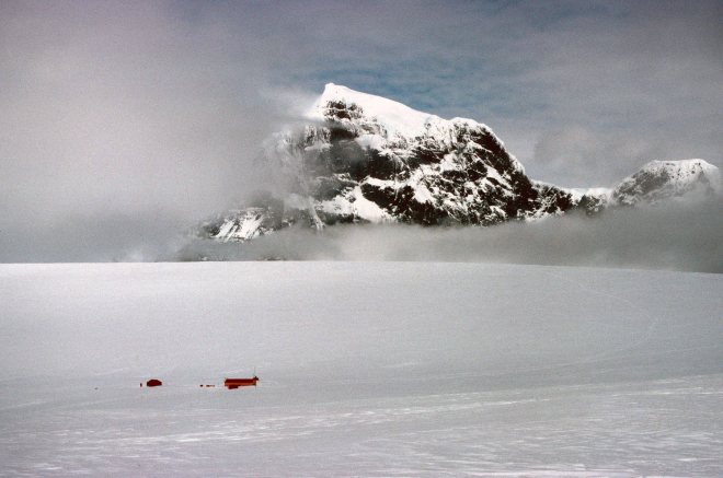
Damoy Hut, Dorian Bay, Wiencke Island. 1982

There was very little to see at Damoy (64 deg and 49 mins south) just two tiny little huts (above) and a temporary snow runway on the glacier above (see below).

Twin Otter landing on the glacier at Damoy Point, Nov 1982

It was not possible to sail all the way south to Rothera (67 deg 34 mins) this early in the season, due to sea ice, so people and supplies were flown down by aircraft. The De Havilland Twin Otters (below) flew down from Canada every season, all the way down South America and across the Drake Passage to the Antarctic Peninsula.

BAS Twin Otter (Alan Light Wiki CC)

It was amazing to see these little, but highly versatile, planes landing on the ice above the huts, on the 400m skiway which ran along the spine of the glacier (below). All they needed was a row of red fuel drums to mark out the landing site.

BAS Twin otter aeroplane landing at Damoy Point. Nov 1982

The Damoy Point hut was established in 1975 and used until 1993/94, I think. After that date, the British Antarctic Survey started flying directly from the Falkland Islands to Rothera base (which is now Britain’s largest research station), so the Damoy Air Facility was no longer required. The hut is now designated a Historic Site and Monument, and is visited by cruise ships, I understand.

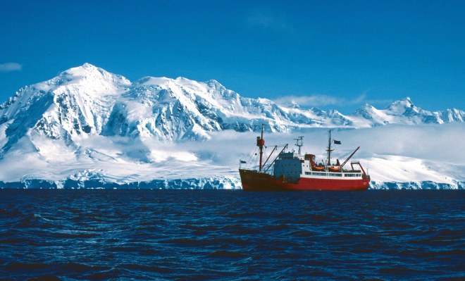
BAS ship the RRS John Biscoe off Anvers Island. Nov 1982

The location off the west coast of Wiencke Island, Antarctic Peninsula, was a beautiful place (above). Mount Français (2,760 m), on Anvers Island (below) loomed above the ship.

Mount Français (2,760 m), Anvers Island from RRS John Biscoe
Anvers Island, Antarctica (GNU Free Documentation License)

One of the nice things about arriving at Damoy Point so early in the austral season (10th Nov), was that the penguins had only just returned to their colonies (below).

Newly returned Gentoo penguins (Pygoscelis papua) at Point Damoy

Gentoo penguins (Pygoscelis papua) are probably my favourite penguin and it was interesting to see them standing around on their colonies, waiting for the last of the snow to melt away.

Gento penguins (Pygoscelis papua)

After dropping off the people heading further south by plane, we also set a southerly course, heading for the BAS base, Faraday Station (Station F), about 40 nautical miles away. This short journey took us through one of the most spectacular places on the Antarctic Peninsula: the Lemaire Channel (below).

RRS John Biscoe entering the Lemaire channel, Antarctic Peninsula (1982)

The Lemaire Channel is a narrow strait between the Kiev Peninsula and Booth Island, and is affectionately known as “Kodak Gap” because everybody who visits takes pictures here. It’s not hard to see why, although I have had to include a modern photograph (below) to illustrate the stark beauty. It was rather a dull day when we sailed though in 1982 (above).

Lemaire Channel, Antarctic Peninsula (Liam Quinn from Canada, Wiki CC BY-SA)

The Antarctic Peninsula is a vast area of stunning natural beauty, and not surprisingly many cruise ships visit the islands and wildlife sites along this finger of land and ice. In 1982, one of the few passenger ships to visit this area was the MS Lindblad Explorer, which I had the pleasure of going aboard a few times (in 1983/84). Since then, cruising to the Antarctic has taken off so to speak (at least it had prior to the current Covid-19 pandemic). At least 50 different cruise ships, of all shapes and sizes, visit the Antarctic each year, taking some 45,000 people (perhaps less, numbers vary). It’s not hard to see why as it is undoubtedly the most beautiful and unspoiled area in the world. But it is also fragile, and the land and wildlife need protecting and managing to ensure that it is not despoiled by the many threats – climate change, irresponsible tourism, invasive species, over-fishing, mineral exploitation etc. – that an expanding human population pose to it.

Mountains on the Antarctic Peninsula

Fore previous blogs on this journey, see:

1) Journey to the Antarctic: 1) Southampton to the Falkland Islands (1982)

2) Journey to the Antarctic: James Ross Island (1982)

Journey to the Antarctic: James Ross Island (1982)

Iceberg (Drake Passage)

We left the Falkland Islands behind us and headed south into the infamous Drake passage. I was on the RRS John Biscoe, heading eventually to the South Orkney Islands, but depositing first, scientists and other support personnel, in various locations on the Antarctic Peninsula.

The RRS John Biscoe in loose pack ice (1982)

Very few cruise ships visited the Antarctic in 1982, I was extremely lucky, and very excited to be visiting some remote locations before I disembarked at my final destination: Signy Island (a British Antarctic Survey research station).

Tabular iceberg

We were heading due south, towards the tip of the Antarctic Peninsula. The weather was kind to us on the crossing and we were able to pass fairly close to a number of icebergs. Seeing an iceberg for the first time is very exciting, and everybody – apart from some of the older hands, perhaps – rushed out on deck clutching cameras. A lot of photographs are taken of the first few icebergs, then gradually, one learns to accept that they will be a constant feature of your life as you head further south! The vast majority of an iceberg is underwater, of course, as this amazing photomontage (below) by Prof. Dr. Uwe Kils, illustrates.

A photomontage of what a whole iceberg might look like. (Work by Uwe Kils) Wiki CC BY-SA 3.0

We sailed down towards Antarctic Sound, at the very tip of the peninsula, an area called Trinity Peninsula (see map below). We were heading to James Ross Island to drop off a field party of geologists, who were going to spend the austral summer working there.

Location of James Ross Island, Antarctic Peninsula. (Apcbg CC BY-SA)

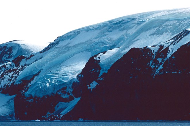
It was an extraordinary experience to sail along a coast of mountainous terrain, covered in glaciers going down into the sea (below).

Trinity Peninsula, Antarctic Peninsula

It was also a strange experience to sail along a coastline and know that there are no humans there, apart from a few tiny huts, research stations, at one or two locations.

Glaciers on Trinity Peninsula, Antarctic Peninsula

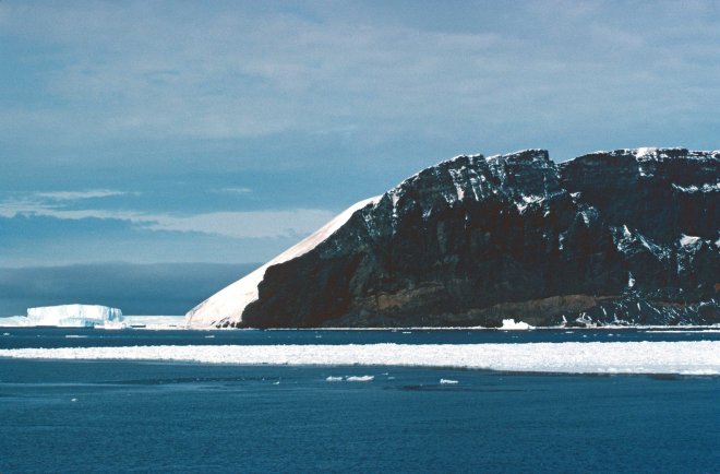
There were huge areas of exposed sedimentary rocks (below), replete with fossils no doubt, that make this area so geologically interesting.

Sailing along the Trinity Peninsula in 1982
On the way to James Ross Island on the RRS John Biscoe in 1982

As we  neared James Ross Island, we came up against loose pack ice. The sound of the ship moving through these pieces of ice is rather disconcerting: thump, thump, thump! But she was ice strengthened and perfectly capable of pushing through (below).

RRS John Biscoe moving through loose pack ice in Antarctic Sound, early Nov 1982

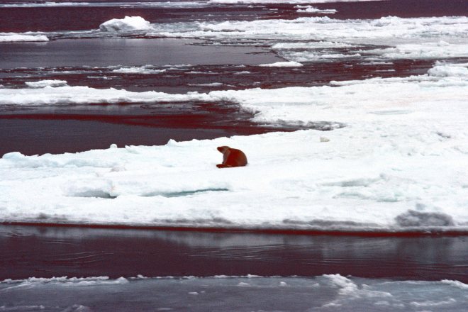
The odd crabeater seal was seen hauled up on an ice floe (below).

Crabeater seal on ice floe

Eventually however, we came up to thick pack ice and could go no further. So, the geologists were deposited on the ice, together with their sleds and ski-dos, some 7 miles away from James Ross Island (below).

Geological field party disembarking on sea ice near Jame Ross Island, c. 9 Nov 1982

In 1982, James Ross Island was connected to the Antarctic Peninsula by the Prince Gustav Ice Shelf . However, this 15 nautical mile (28 km) tongue of ice retreated rapidly between 1989 and 1995, and finally collapsed in 1995 (below). It had gradually shrunk over time from an area of ice covering 2,000 square kilometers (in 1945), to 1600 sq km in 1957, to nothing , in 1995 (Cook & Vaughan, 2010).

Prince Gustav Ice Shelf (PGIS), Antarctic Peninsula, February 1988 James Ross Island project

The Prince Gustav Ice Shelf is just one a number of glaciers (Jones, Wordie, Prince Gustav, Larsen A) that have totally disintegrated, i.e. collapsed within the last half-century in the Antarctic. So James Ross Island looks rather different today (photo taken in 2009, below) than it did in 1982.

A satellite image of James Ross Island, 2009. ASTER-image-03march09

There has been a steady decline in total area of the ice shelves that occur in the Antarctic Peninsula, that began in the 1970s (Cook & Vaughan, 2010), with the areas of ice decreasing by thousands of square kilometers, presumably as a result of global warming. These gone-forever ice shelves have been called ‘ghost-ice-shelves‘. There were there when the first Antarctic explores visited these lands – Nordenskjold was the first person to travel in this area in 1902 (Reece, 1950) – but they are starting to disappear. Slowly breaking off and melting into the sea, which has risen by about four inches, roughly, since I made this trip in 1982!

The following beautiful photograph of James Ross Island was taken during a NZAC (New Zealand Alpine Club, I think!) expedition to Antarctica in 2018. Other (modern!) photographs can be viewed here.

James Ross Island Photo by Jack P. (Flickr CC)

This part of the world is still very isolated and remote, although not quite as much so, as when I visited it in 1982. There are a few cruise ships which venture into the Weddell Sea and attempt to sail through the Prince Gustav Channel, and there is a Czech Antarctic Station (called Mendel) situated on James Ross Island, which was built in the years 2000–2006. So the Antarctic is gradually opening up to humans, but our presence is still very thin, thank God, and the animals – which I will illustrate in forthcoming blogs – mostly have it to themselves.

Link

https://blogs.ei.columbia.edu/2016/11/24/ghost-ice-shelves-and-the-third-antarctic-ice-sheet/

References

Cook, A. J., & Vaughan, D. G. (2010). Overview of areal changes of the ice shelves on the Antarctic Peninsula over the past 50 years. The cryosphere.4(1), 77-98.

Cooper, A. P. R. (1997). Historical observations of Prince Gustav ice shelf. Polar Record33(187), 285-294.

Glasser, N. F., Scambos, T. A., Bohlander, J., Truffer, M., Pettit, E., & Davies, B. J. (2011). From ice-shelf tributary to tidewater glacier: continued rapid recession, acceleration and thinning of Röhss Glacier following the 1995 collapse of the Prince Gustav Ice Shelf, Antarctic Peninsula. Journal of Glaciology57(203), 397-406.

Reece, A. (1950). The ice of crown prince gustav channel, Graham land, Antarctica. Journal of Glaciology1(8), 404-409.

Journey to the Antarctic: 1) Southampton to the Falkland Islands (1982)

Coronation Island from Signy Island, in the South Orkney Islands

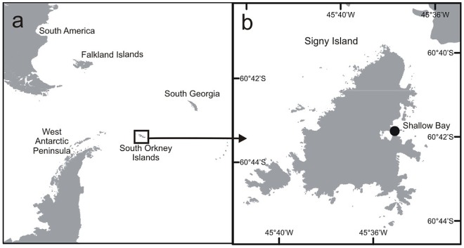
On 21st September 1982, I boarded one of the British Antarctic Survey’s ships, RRS John Biscoe, bound for the Antarctic. I was heading for the BAS base on Signy Island, in the South Orkney Islands (above and below), where I was going to spend 18 months studying the cold hardiness of the few insect and mite species that are found there.

Antarctic Peninsula showing location of South Orkney Islands; and Signy Island (62°42′S, 45°36′W) From J. Reed, et al. (2015): PLOS ONE. Figure. https://doi.org/10.1371/journal.pone.0053477.g001

Family and friends came to see us off at Southampton; an emotional farewell for some, especially those ‘FIDS’ who were going to be away for the full BAS tour of two and half years. The word FID, as I was soon  to learn, is slang for someone living and working in the Antarctic (for the British Antarctic Survey), a term derived from the name Falkland Islands Dependencies. I was to be on board for the next three months.

Departing Southampton on 21 Sept 1982

It was not that long after the end of the Falklands War, (Spanish: Guerra de las Malvinas) and the John Biscoe had been moored alongside the SS Uganda which had been used as a hospital ship in the Falklands war (below). Strangely enough, I had spent a wonderful two weeks on the Uganda as a schoolboy, in 1970, back in the days when it was used for school cruises. But that is another story!

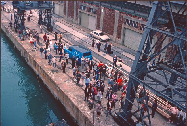
Leaving Southampton on 21 September 1982 (SS Uganda in the background)

Our little ship (1,554 tons), the RRS John Biscoe, looks a lot smaller in these photographs, than I remember, but we felt very safe and secure in her. Her steel plates were riveted together – they don’t make ships like that any more – and she was, technically speaking, 100 A1 ice strengthened (below). More importantly, she and her crew – under the command of Captain Malcolm Phelps – had completed many journeys to the Antarctic and back (since 1956).

RRS John Biscoe in 1982

The Biscoe, as we called her, was a tough little ship, as we soon found out when we ran into some rough weather in the Bay of Biscay (below). Little did I know at the time, that this sort of weather was nothing at all compared to what lay in store for us further south in the Atlantic!

RRS John Biscoe in a moderate sea in the Bay of Biscay Oct 1982

The journey down was a delight. We ‘Fids’ were not required to do an awful lot on board ship. There was a ship’s crew, mostly made up of tough Falkies (from the Falkland Islands), and they did not have any use for us, over than to do a bit of chipping and painting, to keep the ship looking nice.

RRS John Biscoe heading south in the Atlantic in early Oct 1982

I soon learnt that it was a ship not a boat; toilets were called the heads; forward was aft; a tea break was a smoko, and so on.  Fids got to do things like sweeping the bridge and waking up the Mate at 4 am. The fact that some of us had two dgrees (BSc and Phd) cut no ice on the ship, we were the bottom of the pile on board. I didn’t mind and spent my time working – writing up a paper from my Phd research – and sunbathing.

Sailing south on a calm day in mid Atlantic, Oct 1982

It was a long journey down the length of the Atlantic at 12 knots (!) and it took about three weeks to reach our first port of call, Rio de Janiero, Brazil. There were no stops en route, although we did sail close to the Cape Verde Islands and the Saint Peter and Saint Paul rocks – a group of 15 small islets and rocks in the middle of the Atlantic Ocean owned by Brazil (below).

Saint Peter and Saint Paul rocks, Brazil (Saint Peter and Saint Paul rocks, Brazil)

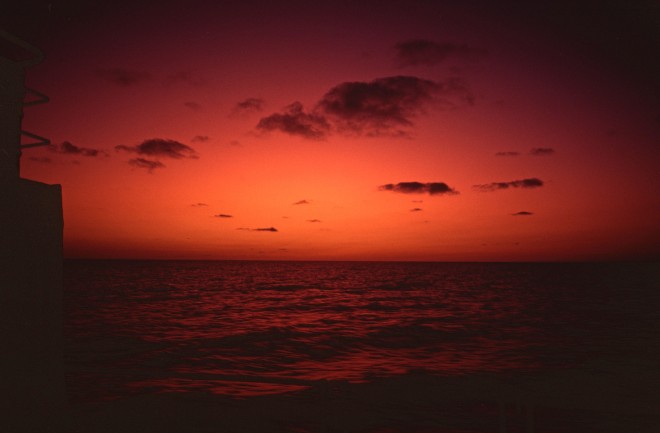
Luckily there was plenty of alcohol on board (duty free!) so one of the daily rituals was to observe the sunset (below), clutching a glass of your favorite tipple!

Ocean sunset somewhere in the mid Atlantic

Another time honored tradition was that of the Crossing the Line Ceremony. I can’t say that I enjoy these rites of passage, and luckily I escaped on this occasion as I had crossed the equator before on a ship.

‘Crossing the line’ ceremony aboard RRS John Biscoe. Oct 1982

This period of steady ocean travel was one of the most peaceful and enjoyable experiences of my life. I recall seeing a pod of spinner dolphins moving along in an opposite direction to us; the odd ocean sunfish swimming along just under the surface and seabirds of course. I am ashamed to say that I was not a bird watcher at the start of this adventure, but I was an avid birder by the time we returned to the UK (in 1984).
RRS John Biscoe heading south at 12 knots

I probably should add, that the British Antarctic survey only recruited men to overwinter in the Antarctic in those days! Fortunately, it is a very different state of affairs these days, and the Director of BAS is now a woman: ‎Professor Dame Jane Francis. Much could be written about this policy, which did not change for a further 10 years or so (see here: The evolving role of women at BAS) after I went to the Antarctic, but that is not my purpose here.

We eventually arrived in Rio de Janeiro about the 11 Oct 1982, and we were let loose to sample the delights of the city for a couple of days, whilst the ship refueled and stocked up on fresh food.

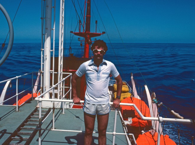
The author aged 27, on board ship whilst moored in Rio de Janeiro docks Oct 1982

After leaving Rio, we headed out into the Atlantic, bound for the Falkland Islands. As a result of the Falklands conflict, we had to steer clear of Argentinian territorial waters as we sailed south. Soon after leaving Rio we ran into an almighty storm, which reached Storm Force 12 on the Beaufort scale at one point. At those wind speeds, the definition between sea and sky becomes blurred and air is filled with foam and spray. I took the following photo (below) long after the peak, when we were certainly not allowed on deck and had to lie down in our bunks wedged between the mattress and the bulk head. Even going to the toilet (sorry, heads!) was a dangerous activity.

Huge waves in a Storm Force 12 in the South Atlantic

To make matters worse, the ship gradually started to lose power during the storm. The fuel pumps started to pack up, and one by one the cylinders started to give up. Eventually we were left bobbing about in the open ocean. Fortunately, by the time the ship lost power completely, the storm had abated. The rumour was that the Brazilians had spiked (adulterated) the fuel we loaded in Rio, as an act of support for the recently defeated Argentinians. Whether this was true or not I don’t know, but it meant that we had to wait for an ocean-going tug to come out from southern Brazil and tow us into port, where we stayed for about 8 days (waiting for spare parts to be flown out from the UK).

Brazilian tug boat

We eventually arrived in the southern Brazilian city of Rio Grande do Sul , on 22 Oct 1982.

Rio Grande do Sul, Brazil. c. 20 Oct 1982

The inhabitants of this small city were very welcoming and it was a great experience to get a taste of southern Brazil.

Docks at Rio Grande do Sul, Brazil. 22 Oct 1992

Local people were allowed to visit the ship, so we got to know, and experienced the hospitality of some of them. I am sad to say that I have never been back to this part of the world, but I would like to.

Entertaining some Brazilian visitors on board the RRS John Biscoe, in Rio Grande do Sul, Brazil. c. 21 Oct 1982. I am on the left.

After leaving southern Brazil, we sailed south towards the Falkland Islands. As we entered into the Falkland Island exclusion zone, we were buzzed by a RAF Hercules aeroplane, just checking out who we were I suppose. Early the next day, as we got closer to the islands, a Royal Navy frigate (HMS Phoebe) appeared, going much faster than our stately 12 knots.

Leander-class frigate HMS Phoebe 4 Nov 1982

We did not stay long in the Falkland Islands and were not allowed to wander far from the ship. The war had only ended a few months previously and there was still a lot of activity going on, most notably mine clearance operations. The only time I managed to get ashore was to get my tooth fixed by an army dentist!

Because of all the ships that were still there, we had to tie up against the burned out hulk of the RFA Sir Tristram (below), which was badly damaged at Fitzroy on 8 June 1982. It was however, still being used as an accommodation ship.

RFA Sir Tristram at Port Stanley in Nov 1982 after being bombed at Bluff Cove

The awful damage to this ship, and its sister ship RFA Sir Galahad was inflicted during the Bluff Cove air attacks in 8 June 1982, during the Falklands War. A total of 56 British servicemen were killed, and 150 wounded in this bombing, and is was harrowing to walk around the remains of the ship. One couldn’t help but imagine what a horrifying inferno it must have been for the Welsh Guards on board. Horrific events were suffered by both sides in this conflict.

RFA Sir Tristram at Port Stanley in Nov 1982 after being bombed in Bluff Cove

After a brief stop in Port Stanley, we left the Falkland Islands in early November 1982, heading south across the Drake Passage, bound for the Antarctic Peninsula (which I will descibe in a following blog).

RRS John Biscoe off Damoy Point in the Antarctic Peninsula (c. 64 deg S) Nov 1982

All photographs were taken by me using an Olympus OM10 film camera, using Kodachrome film. The rather ageing transparencies were digitised using a Nikon Coolscan V.